CRC-P57322 “High-resolution Real-time Airborne Gravimetry"
To date our most significant project has been a project undertaken with a CRC-P grant, entitled “High-resolution Real-time Airborne Gravimetry”. This project received grant funding from the Australian Government through the CRC-P Program. To find out more please click on the logo below

This project aimed to dramatically improve the spatial resolution of airborne gravity data by integrating a new lightweight gravimeter with breakthrough NASA technology. The target is to eventually improve the resolution of the system from kilometres to hundreds of metres. We also aimed to remove range limitations of existing GPS-based technology, and test the feasibility of transmission of processed gravity data to project managers, in real-time.
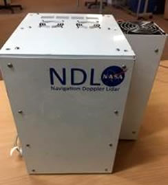
Lidar (NDL) electronics
The project was led by Dr Andy Gabell.
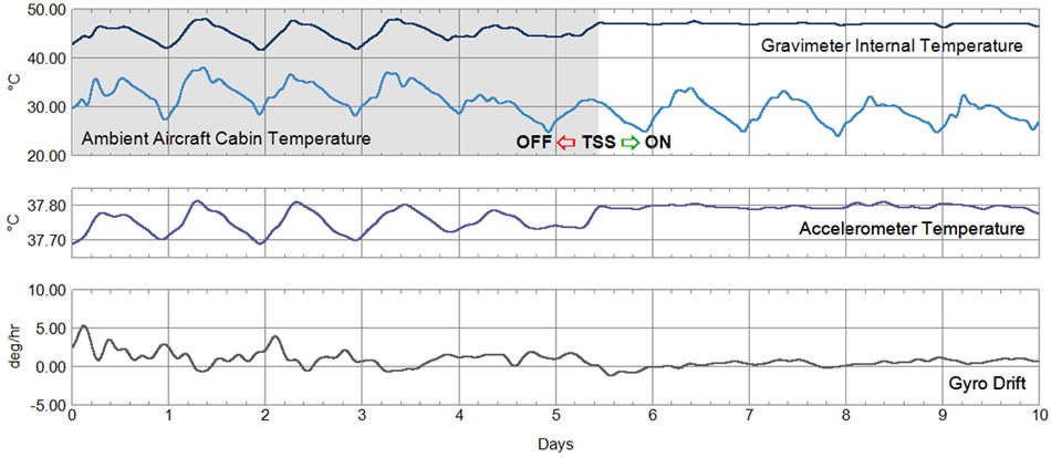
The current limitation of scalar gravimeter systems stems from limitations of GPS/GNSS. GPS is used to determine the aircraft’s inertial accelerations, which must be subtracted from the total accelerations (inertial aircraft + gravity accelerations) as measured by the gravimeter. In order to achieve the accuracy required, the GPS data must be filtered over a relatively long period of time, of the order of 100 seconds. This results in gravity data with a resolution generally measured in kms. The premise behind the project was that a very accurate Doppler Lidar, such as the Navigation Doppler Lidar, or “NDL” developed by scientists at NASA Langley Research Center (see https://technology.nasa.gov/patent/LAR-TOPS-95) should be able to measure the inertial accelerations of an aircraft much more accurately than is possible with GPS/GNSS. If so, then the use of shorter filter lengths, resulting in gravity data with improved resolution, should be possible.
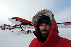
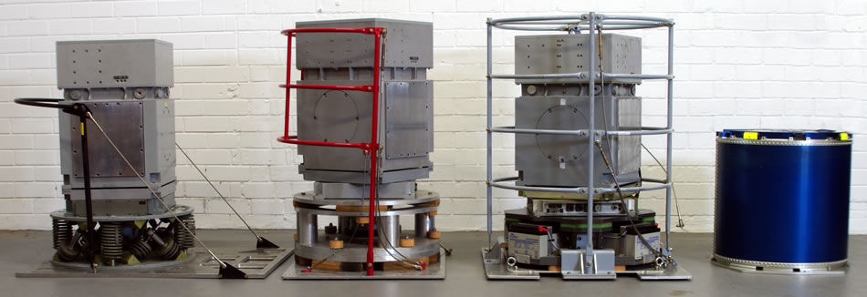
One of the project collaborators, Intuitive Machines LLC of Houston TX, was able to negotiate access to one of the NASA prototypes for the project. The NDL was subsequently used to acquire repeat line gravity data in 3 campaigns – the first in Utah, USA with a GT-2A gravimeter, and the second and third in Australia with a GTz® gravimeter. The GTz® gravimeter was also developed to the operational prototype stage by the project.
The project was able to demonstrate that:
- it is possible to consistently produce lower noise data using integrated NDL and GPS data to determine the aircraft inertial accelerations, compared to using GPS data alone;
- it is also possible to produce sub-mGal (rms) free air gravity data just using the NDL data (without GPS) to determine aircraft inertial accelerations. This means that it is feasible to produce free air gravity responses in real-time, and that the limitations on range (from the requirement to view the same satellites from both rover and base GPS receivers) may eventually be removed.
We believe that the results obtained during this project have just scratched the surface, and Transparent Earth Geophysics is now working collaboratively on development of an instrument tailored for airborne gravimetry.
Australian patent AU AU2016904026 was granted for this concept on the 13th December 2018. USA patent US 10,838,104 B2 was granted on the 17th November, 2020. Patents have also been granted in a number of other countries.
- View the Australian Patent
- View the USA Patent
- View the Canadian Patent
- View the European Patent
- View the Eur/Asian Patent
For more information please contact Dr Andy Gabell at
The following organisations were research partners in the CRC-P project:
![]()


![]()


![]()
This is what some of the participants had to say about the CRC-P project:
Intuitive Machines: “Working on the CRCP effort was immensely rewarding. We directly benefited from developing several novel approaches to applying the base technologies to geophysical surveys which have cross-sector applications into aviation and space. Additionally, there were many benefits from expanding our network into a team of diverse professionals in the aviation, geology, academic, and technology sectors both in America and Australia. We would most definitely consider being on another CRCP team or effort.”
Geoscience Australia: “This project has explored the limitations of existing instruments and has given fascinating insight into what can be achieved with more sophisticated combinations of existing technology. The role of the CRC-P has been crucial in achieving the aims of this research and development project, which may shape the future of airborne gravity surveying."
Curtin University: "This was Curtin University's first ever involvement in a CRC-P. It has opened up some extremely exciting new directions and led to collaborations on airborne geoid determination. Also, a new PhD student (Todd Lyon) has enrolled in a project solely because of this CRCP. All in all, a great success."
Airship Solutions: “As a participant of the CRC-P project, we received value from being part of a large project, and having the benefit of observing the value it contributed. We were able to develop a lot of intangible skills which will benefit us with projects moving forwards due to the nature of our participation.”
Airborne Research Australia: “Airborne Research Australia greatly values the outcomes from the CRC-P. Aside from the scientific satisfaction of participation in a successful technology development, the project allowed ARA to further develop its capabilities for the installation of large scientific payloads to its aircraft, to advance its capacity and certification for UAV operations, to further build its space-related credentials through the opportunity to test fly cutting-edge NASA instrumentation, and to develop good working relations with several other organisations which we sincerely hope will continue.”